
Prints, Polls, and Progress
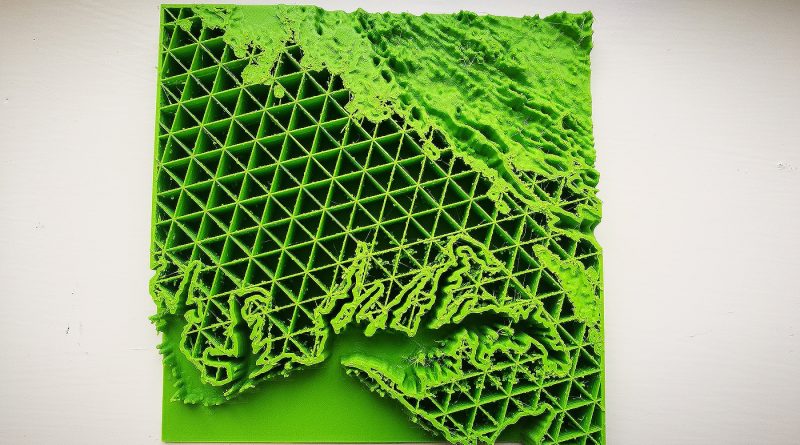
After some much needed rest and relaxation from spring break our team is back and ready to work. With the help of Professor Taahlman and her own blog tutorial, the group learned how to take grayscale topographic maps and turn them into 3D printable maps. To start we researched images through ARC GIS, Harrisonburg GIS, and NASA. We were then able to take these topographic images and upload them to our classrooms Cura software. As you can see below, our first attempt at printing these images was going great until our printer ran out of filament. Nonetheless, we are continuing with printing the different images we’ve acquired to see which image would be the best to print on a larger scale.
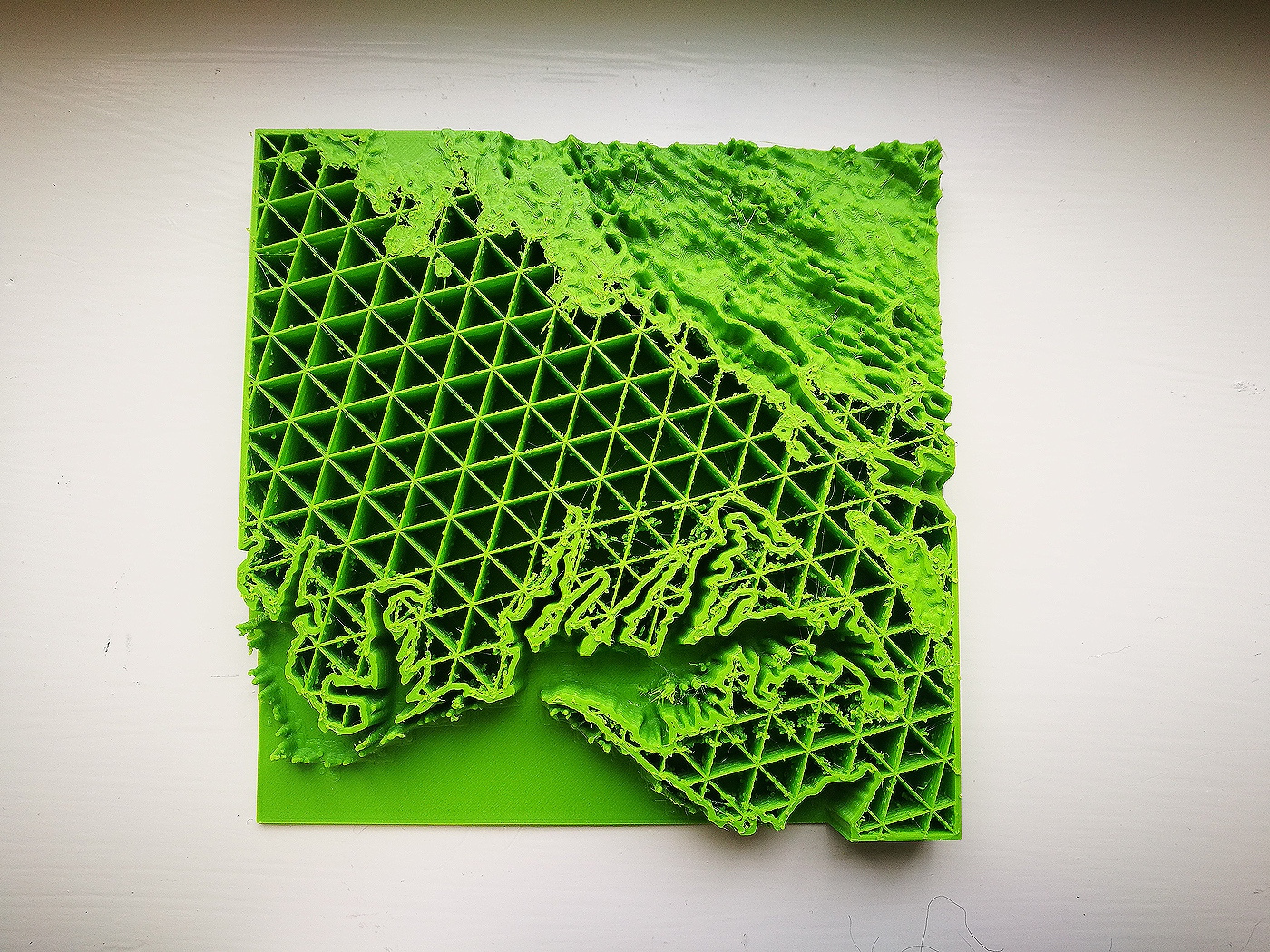
The picture above was our first print made for Massanutten. It wasn’t completed due to the fact that the printer itself ran out of filament. But hey. it’s a start!
This is a video of us printing the Massanutten Mountain again!
Base on some research, we find out that the history of the 3D printing is very short only 30
years and it is still in the development stage. It is very incredible that how fast it is. We also saw that there is someone 3D printing the hamburgers. We planned to have the 3D printing class in our classroom. We sent out the doodle to set up a finalized class schedule and we are still waiting for the response of the people. We are excited about the research we’re doing for the mountain. Going forward, we are hoping to take (maybe depending on time) a group trip to Massanutten or contact someone in the historical field there about their view on the area and why people and guests love that spot.
We’re not going to lie, it has been a little stressful with all the trial-and-errors we went through, along with feeling discouraged about concepts and ideas getting shut down. However, we are happy that we finally have found (and stuck with) our geographic map idea. We picked the Massanutten region for our project because of its natural beauty/ landscape, its historical demographics, and (mainly) intrigued with thumbprint.
During research, we discovered that this Massanutten is known as the “classics” area in Virginia. We didn’t know much background about the area in the beginning; however, while in the researching process it’s been interesting at what we’ve been finding. “The Massanutten Country. Where the first settlement was made in the Shenandoah Valley of Virginia.” Forerunners: A History or Genealogy of the Strickler Families Their Kith and Kin, by Harry M. Strickler (Harrisonburg, Virginia: 1925), pp. 21-22 The region’s landscape is along the Shenandoah River where throughout history, many historical events took place. For example, European Colonization, the American Revolution, the Civil War, and hundreds more important eras and “worthy happenings” that everyone had to learn about from middle school to now in college history. I think we’ve never been more impressed with the abundance of historical information that is minutes away from the university.
We are still researching how exactly the “thumbprint” came to be. From readings in our research, we found that a thumbprint on the Appalachian trail is on Burke’s Garden? Location wise (and looking at the map) we didn’t seem it was in the correct area. We are still in the process of finding the story behind Massanutten’s thumbprint. Stay tuned…..
http://www.wendtroot.com/cockrill/d0004/d0004notes/MassanuttenHistory.html