Representing the World in 3D

Representing the World in 3D

JMU UNST 390 – Spring 2018

  • Home
  • Timeline
  • Assignments
  • 3D Education
  • Maps of America
  • Braille Maps
  • Better Than Apple
Election Day!
Front Slider Maps of America 

Election Day!

April 25, 2018 Map Guys Comments Off on Election Day!
Maps and Floor Plans
Braille Maps Front Slider Uncategorized 

Maps and Floor Plans

April 25, 2018 BrailleWiz Comments Off on Maps and Floor Plans
From S.V.G to M.A.P.
3D Education Front Slider 

From S.V.G to M.A.P.

April 25, 2018 Educational Dukes Comments Off on From S.V.G to M.A.P.
A Progression of Faces
Better Than Apple Front Slider 

A Progression of Faces

April 24, 2018 Scanners Comments Off on A Progression of Faces
Slicing & Scaling in the Lab
3D Education Front Slider 

Slicing & Scaling in the Lab

April 11, 2018 Educational Dukes Comments Off on Slicing & Scaling in the Lab
Campus Map
Braille Maps Front Slider Uncategorized 

Campus Map

April 11, 2018 BrailleWiz Comments Off on Campus Map
Fusion360 Troubles
Braille Maps Front Slider Uncategorized 

Fusion360 Troubles

April 11, 2018 BrailleWiz Comments Off on Fusion360 Troubles
The Election is Near…
Front Slider Maps of America 

The Election is Near…

April 11, 2018 Map Guys Comments Off on The Election is Near…
A Combination of Approaches
Better Than Apple Front Slider 

A Combination of Approaches

April 11, 2018 Scanners Comments Off on A Combination of Approaches
Inching Closer
Better Than Apple Front Slider 

Inching Closer

April 11, 2018 Scanners Comments Off on Inching Closer
Maps, Money, and World Trade
Front Slider Maps of America 

Maps, Money, and World Trade

April 4, 2018 Map Guys Comments Off on Maps, Money, and World Trade
“Keep Moving Forward”
Front Slider Maps of America 

“Keep Moving Forward”

April 4, 2018 Map Guys Comments Off on “Keep Moving Forward”
3D Printing Massanutten
3D Education Front Slider 

3D Printing Massanutten

April 2, 2018 Educational Dukes Comments Off on 3D Printing Massanutten
From Carrier Library to Roop Hall
Braille Maps Front Slider 

From Carrier Library to Roop Hall

March 26, 2018 BrailleWiz Comments Off on From Carrier Library to Roop Hall
Starting Again
Better Than Apple Front Slider 

Starting Again

March 26, 2018 Scanners Comments Off on Starting Again
Prints, Polls, and Progress
3D Education Front Slider 

Prints, Polls, and Progress

March 21, 2018 Educational Dukes Comments Off on Prints, Polls, and Progress
Running Closer and Closer to Election Time
Front Slider Maps of America 

Running Closer and Closer to Election Time

February 28, 2018 Map Guys Comments Off on Running Closer and Closer to Election Time
Finally… Two Working Prints!
Braille Maps Front Slider Uncategorized 

Finally… Two Working Prints!

February 28, 2018 BrailleWiz 1
Where Our Big Ideas Are Headed!
3D Education Front Slider 

Where Our Big Ideas Are Headed!

February 28, 2018 Educational Dukes Comments Off on Where Our Big Ideas Are Headed!
Adding the Eyes
Better Than Apple Front Slider 

Adding the Eyes

February 26, 2018 Scanners Comments Off on Adding the Eyes
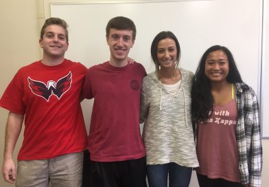
The Geography Team
3D Education Teams 

The Geography Team

February 14, 2018 Educational Dukes Comments Off on The Geography Team
The Electoral Map Team
Maps of America Teams 

The Electoral Map Team

February 13, 2018 Map Guys Comments Off on The Electoral Map Team
The Braille Map Team
Braille Maps Teams Uncategorized 

The Braille Map Team

February 12, 2018 BrailleWiz Comments Off on The Braille Map Team
The Face Recognition Team
Better Than Apple Teams 

The Face Recognition Team

February 7, 2018 Scanners Comments Off on The Face Recognition Team

3D Education

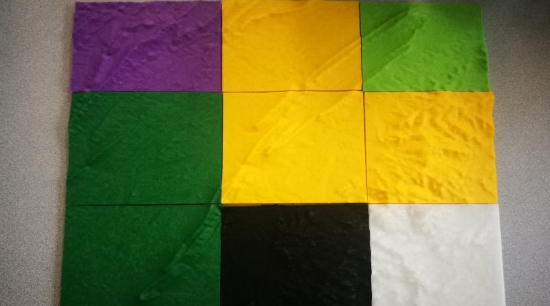
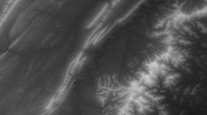
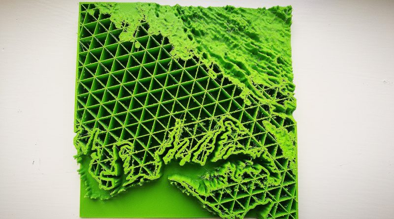
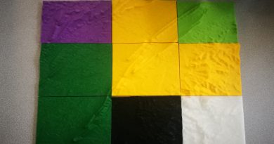
Are you interested in figuring out how 3D printing could improve your learning capability inside or outside of the classroom? We'll illustrate how you can print 3D gegraphical regions with a 2D height-map image file and make the print come to life! Come adventure with us as we take you through the Massanutten region and compare multiple softwares for 3D printing geography.
From S.V.G to M.A.P.
3D Education Front Slider 

From S.V.G to M.A.P.

April 25, 2018 Educational Dukes Comments Off on From S.V.G to M.A.P.

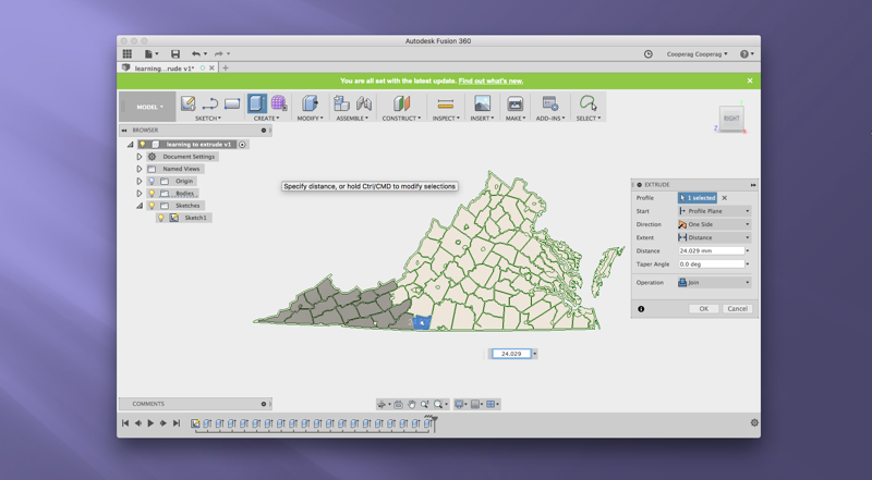
In the last few weeks we have played with new software to create a video tutorial of our process. We hope you enjoy the blog, along with a lesson plan for taking this project to the classroom. Check it out!

Slicing & Scaling in the Lab
3D Education Front Slider 

Slicing & Scaling in the Lab

April 11, 2018 Educational Dukes Comments Off on Slicing & Scaling in the Lab
3D Printing Massanutten
3D Education Front Slider 

3D Printing Massanutten

April 2, 2018 Educational Dukes Comments Off on 3D Printing Massanutten
Prints, Polls, and Progress
3D Education Front Slider 

Prints, Polls, and Progress

March 21, 2018 Educational Dukes Comments Off on Prints, Polls, and Progress
Where Our Big Ideas Are Headed!
3D Education Front Slider 

Where Our Big Ideas Are Headed!

February 28, 2018 Educational Dukes Comments Off on Where Our Big Ideas Are Headed!

Maps of America

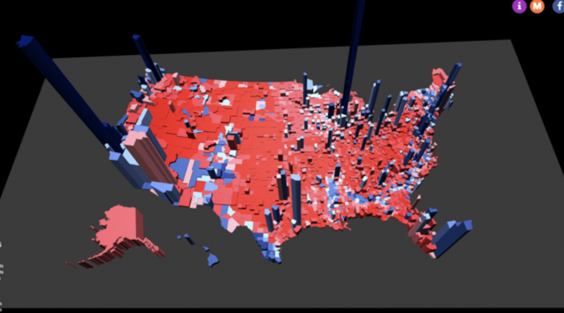
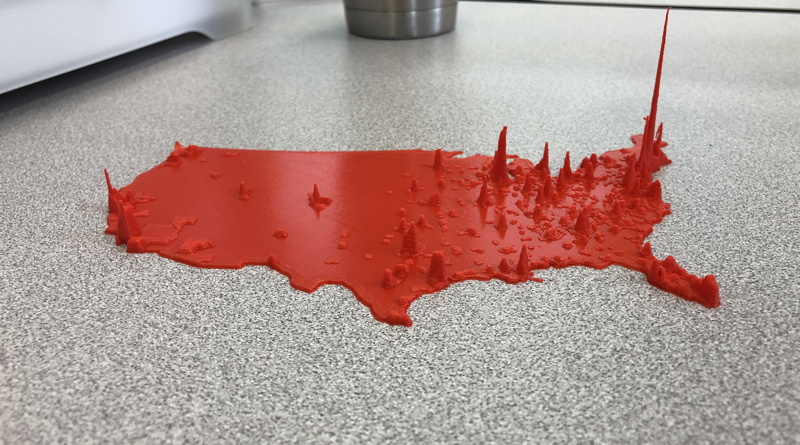
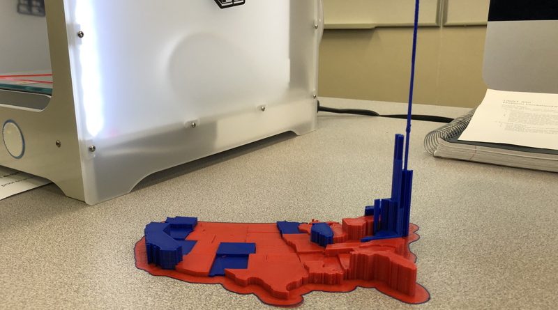
Have you ever wondered what the presidential election looks like as 3D print? We have taken the electoral college and transformed electoral vote into 3D prints. Through trial and error we have created these maps as a visual learning tool to better understand how the electoral college works in elections.
Election Day!
Front Slider Maps of America 

Election Day!

April 25, 2018 Map Guys Comments Off on Election Day!

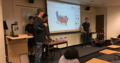
We have reached the end point of the semester that is filled with final products and final presentation. We hope you will enjoy looking back at progress and hopefully recreating something better!

The Election is Near…
Front Slider Maps of America 

The Election is Near…

April 11, 2018 Map Guys Comments Off on The Election is Near…
Maps, Money, and World Trade
Front Slider Maps of America 

Maps, Money, and World Trade

April 4, 2018 Map Guys Comments Off on Maps, Money, and World Trade
“Keep Moving Forward”
Front Slider Maps of America 

“Keep Moving Forward”

April 4, 2018 Map Guys Comments Off on “Keep Moving Forward”
Running Closer and Closer to Election Time
Front Slider Maps of America 

Running Closer and Closer to Election Time

February 28, 2018 Map Guys Comments Off on Running Closer and Closer to Election Time

Braille Maps

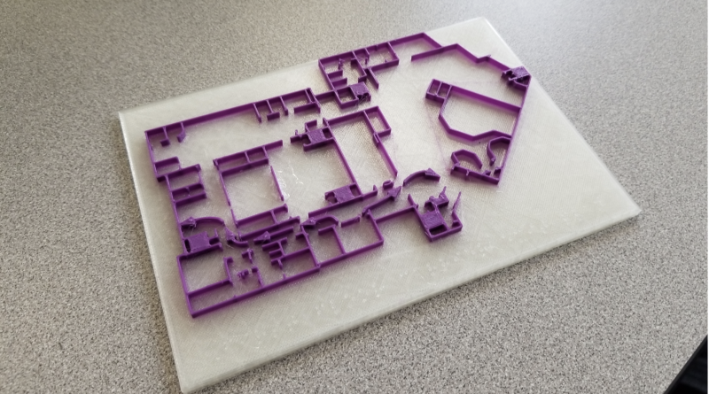
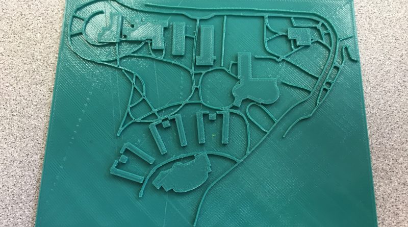
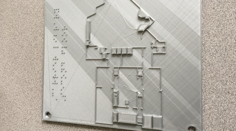
BrailleWiz is a group of four dedicated students who are commited to making students who are visually impaired more accessible around campus. By utilizing Braille and floor maps, we are able to create 3D prints of specific buildings on campus. In addition, by creating a campus map that is 3D, students will be able to visually feel James Madison University.
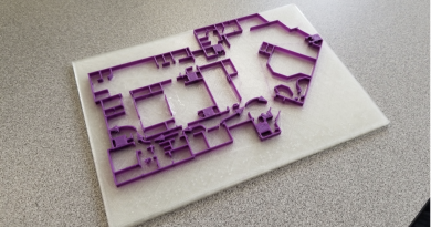
Maps and Floor Plans
Braille Maps Front Slider Uncategorized 

Maps and Floor Plans

April 25, 2018 BrailleWiz Comments Off on Maps and Floor Plans

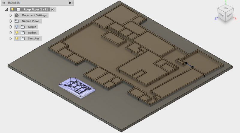
The Braille Wiz team shares their final products after completing the semester: 3D printed tactile campus maps and floor plans for the different floors of Roop Hall and Carrier Library…

Campus Map
Braille Maps Front Slider Uncategorized 

Campus Map

April 11, 2018 BrailleWiz Comments Off on Campus Map
Fusion360 Troubles
Braille Maps Front Slider Uncategorized 

Fusion360 Troubles

April 11, 2018 BrailleWiz Comments Off on Fusion360 Troubles
From Carrier Library to Roop Hall
Braille Maps Front Slider 

From Carrier Library to Roop Hall

March 26, 2018 BrailleWiz Comments Off on From Carrier Library to Roop Hall
Finally… Two Working Prints!
Braille Maps Front Slider Uncategorized 

Finally… Two Working Prints!

February 28, 2018 BrailleWiz 1

Better Than Apple

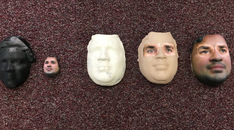
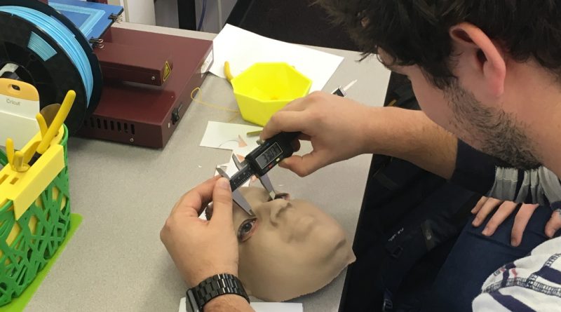
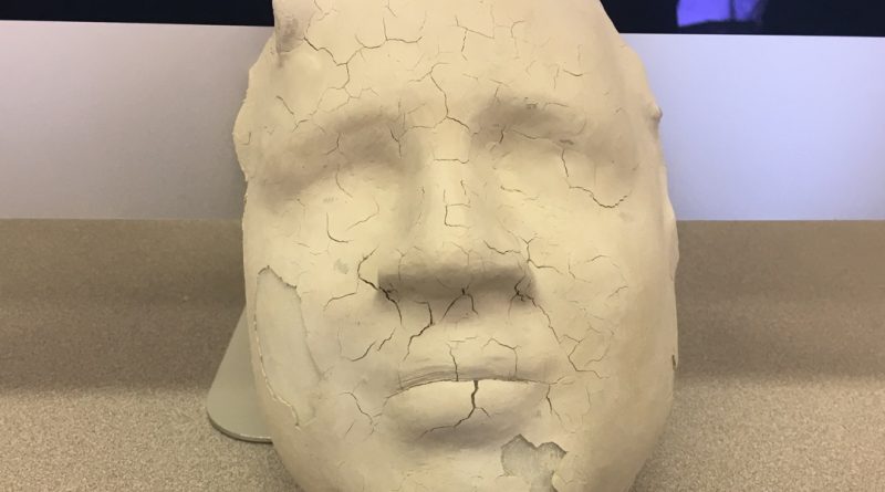
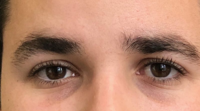
Better Than Apple’s main goal was to 3D print a mask that could trick the iPhone X’s facial recognition software. We wanted to know if it could be done by University students working with a small budget. Using the tools we were taught in our critical thinking course, we created masks that we believed had a chance. Our approach was predominantly trial and error which quickly began to produce quality attempts.
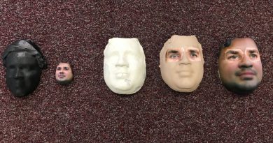
A Progression of Faces
Better Than Apple Front Slider 

A Progression of Faces

April 24, 2018 Scanners Comments Off on A Progression of Faces

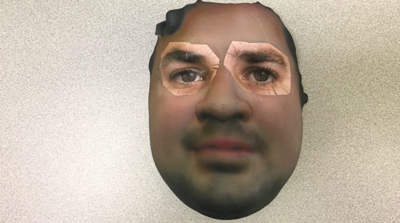
We didn’t fool Apple, but we got close! In this post we look back on the progress we’ve made and leave behind a summary of how others can attempt this challenge, starting from where we left off…

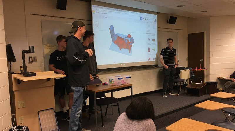
A Combination of Approaches
Better Than Apple Front Slider 

A Combination of Approaches

April 11, 2018 Scanners Comments Off on A Combination of Approaches
Inching Closer
Better Than Apple Front Slider 

Inching Closer

April 11, 2018 Scanners Comments Off on Inching Closer
Starting Again
Better Than Apple Front Slider 

Starting Again

March 26, 2018 Scanners Comments Off on Starting Again
Adding the Eyes
Better Than Apple Front Slider 

Adding the Eyes

February 26, 2018 Scanners Comments Off on Adding the Eyes

Course Links

  • Syllabus and Policy
  • Formatting Requirements

Hardware

Design

UNST 390

Representing the World in 3D is a new University Studies UNST 390 course held in the JMU 3SPACE 3D printing classroom.

The course focuses on critical thinking, independent research, and hands-on design thinking. Student projects will represent real-world data, objects, and locations with digital and printable 3D designs.


Copyright © 2017 Representing the World in 3D.
Powered by WordPress using ColorMag by ThemeGrill.

JMU 3SPACE

University Studies

About the Professor

Copyright © 2023 Representing the World in 3D. All rights reserved.
Theme: ColorMag by ThemeGrill. Powered by WordPress.