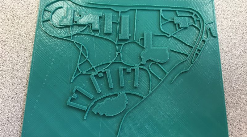
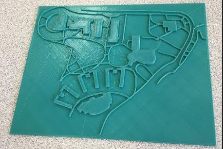
Campus Map
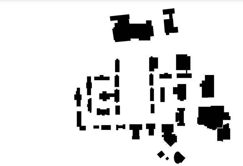
Skyline
Our first successful print of the skyline section of campus with the walkways finally came out correct, where last week we tried to print, but when we came to check on our print, someone had thrown it away because it messed up. We’ve decided that outlining the walkways is the most efficient way to get them into tinkercad after trying to use inkscape and other software. We had to import two separate files into tinkercad so that we could make the walkways a different height than the buildings so that our end user can better feel the campus. Our next step is going to be deciding what braille and where it will go to best give visually impaired people an idea of what the whole campus feels like at a high level view. Once we are able to successfully print each section of campus, the next step we will need to overcome is finding out how to fit the pieces together in a functional way. This is going to involve lining up all the pathways and buildings correctly which will be a difficult task.
Bluestone
The next section of campus we are going to be working on is the bluestone section of campus, where using Inkscape, we have already outlined all the buildings and have created an SVG file which an be imported into tinkercad. We have to outline the walkways still, and are trying to find the best and most efficient way to do this so that our sections will match up when we try and put it all together as the full campus.