
Maps and Floor Plans
Final Floor Plans
As stated in our first blog post, the goal of our project was to aid blind students when they are trying to learn the campus and get a sense of their direction. We chose this subject because it is extremely relevant to the real world. Current campus maps and directories lay flat on a single piece of paper. Having an idea of building size, structure, and proximity to other campus resources are important in having a fulfilling college experience. Originally, we wanted to incorporate braille on our 3D maps. We tested our braille out on several prints and ultimately decided that it took away from the overall floor plan. Being that this was a semester-long project, we wanted to spend more of our time and energy on maps rather than making sure the braille was up-to-code.
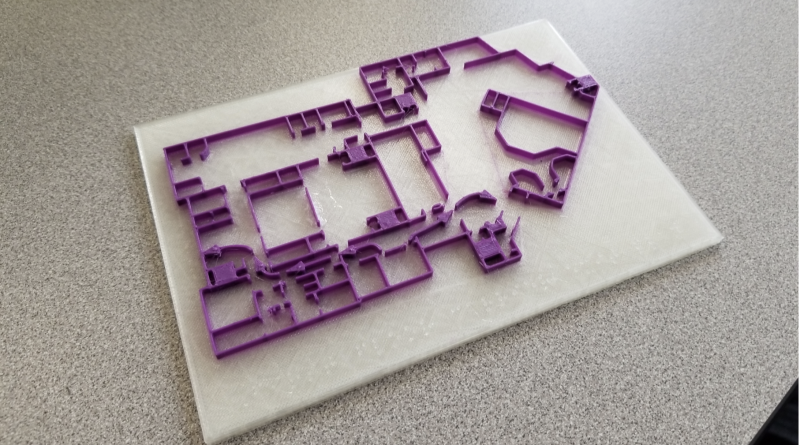
Our original designs all of of the Carrier library floors were unable to be implemented due to some “administrative issues”. So instead Dr. Taalman suggested we make a map of first floor Carrier to hang up in our classroom. We ended up including the exit arrows just like the paper map to help assist people. With the help of Lucas from Innovation Services we were able to load up an Ultimaker3 with clear and “Dukes” purple. Due to its small size the map is not very sight impaired friendly but the bright purple lines on a clear backer make it much better too look at then the black and white paper map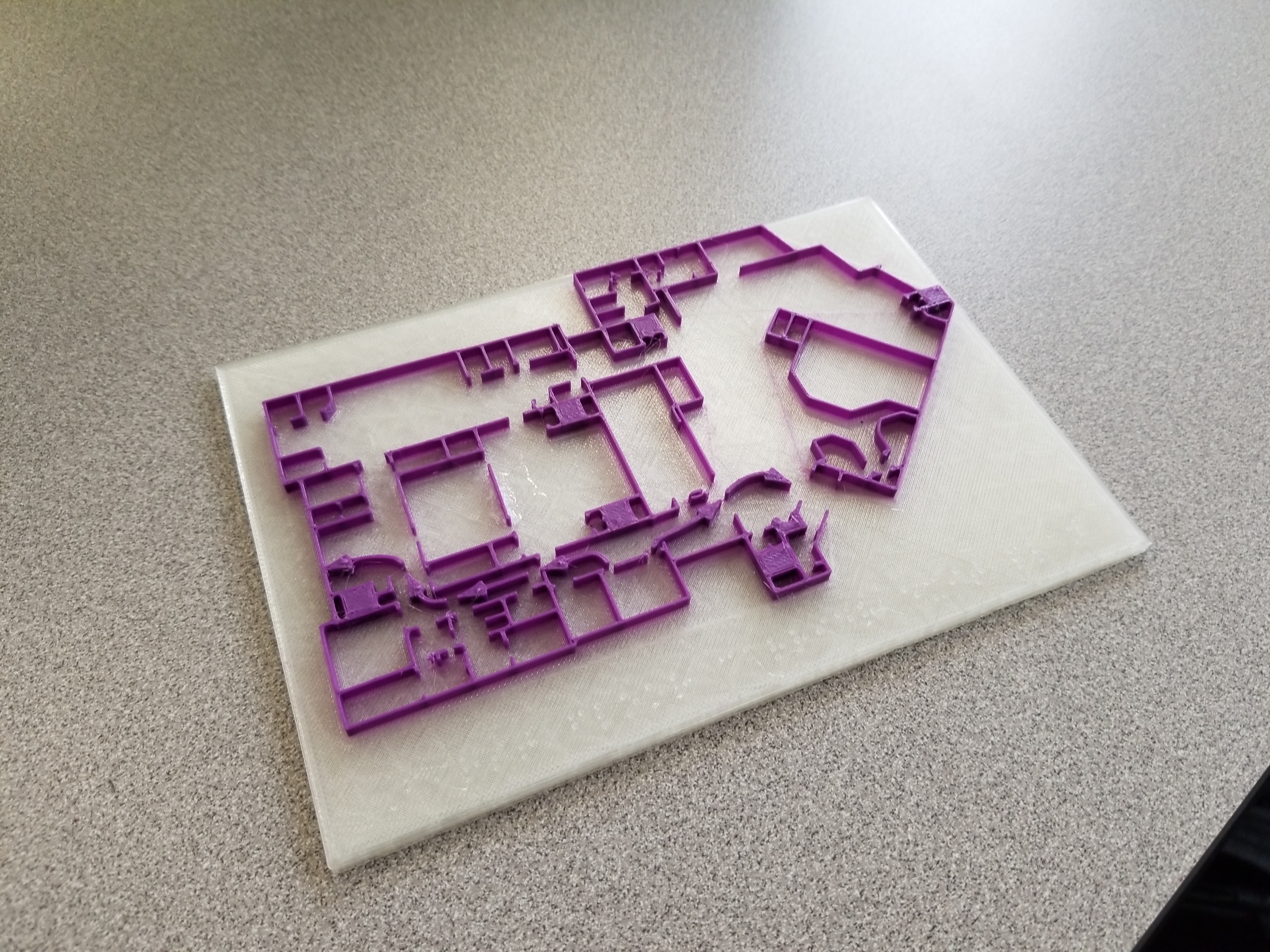
Final External Presentation
 For our external presentation, we set up an appointment with Christopher Kinney and Brandon of Disability Services. We discussed our semester-long project, goals, obstacles and finally presented our results. Overall, they were extremely impressed by our project, and if it were to move forward with the addition of braille, they would happily implement it. They recommend having another group continue this project with a few adjustments. With bigger rooms and more room for Braille, we would ensure a more accurate Braille reading. The two men offered a bunch of support and if our group was not graduating and able to continue they would see how this project could be used on JMU’s campus.
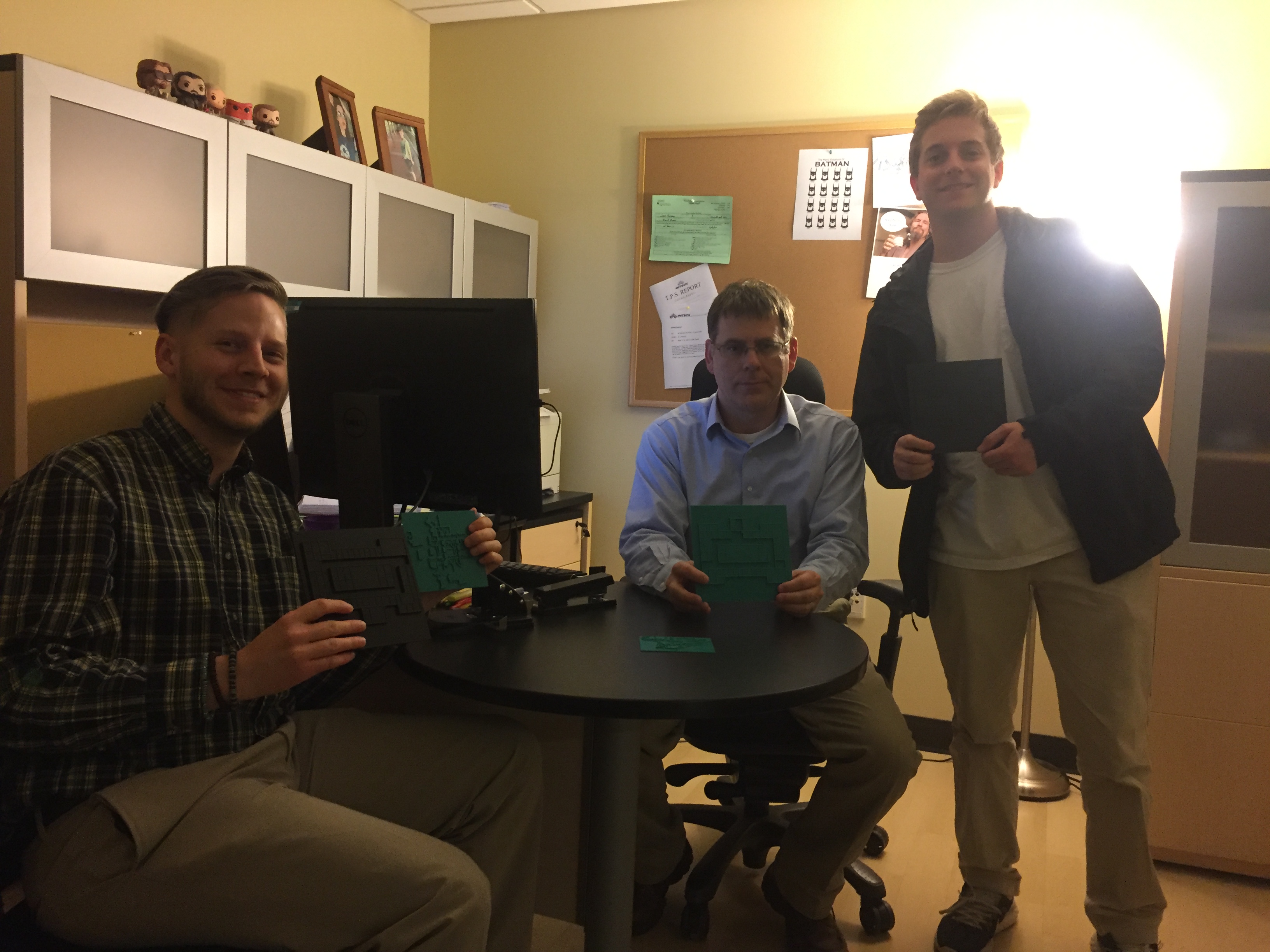
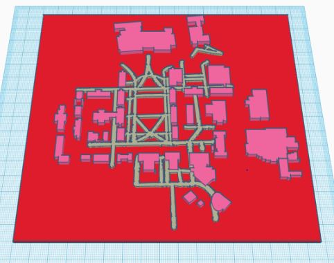
Campus Map
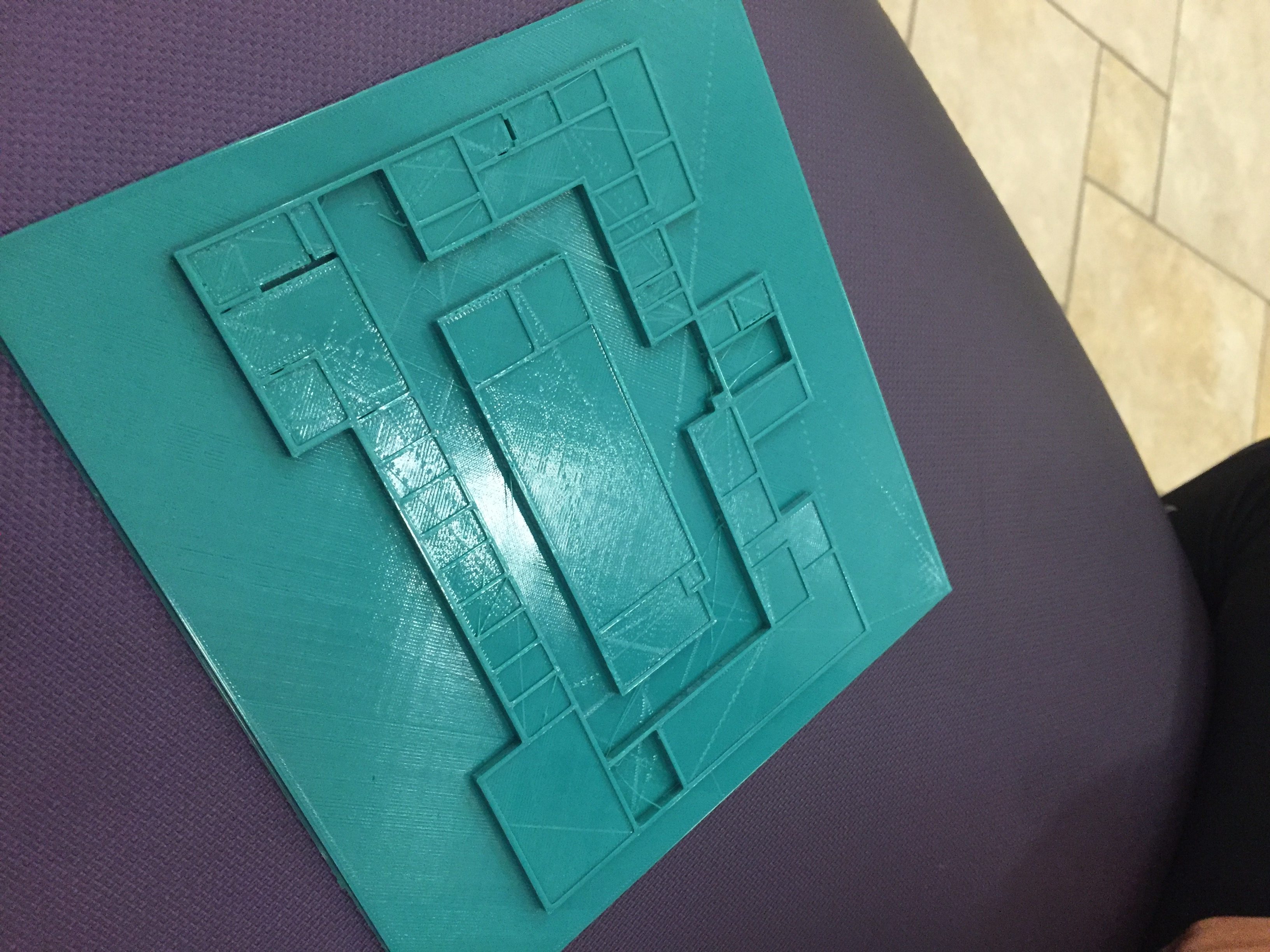
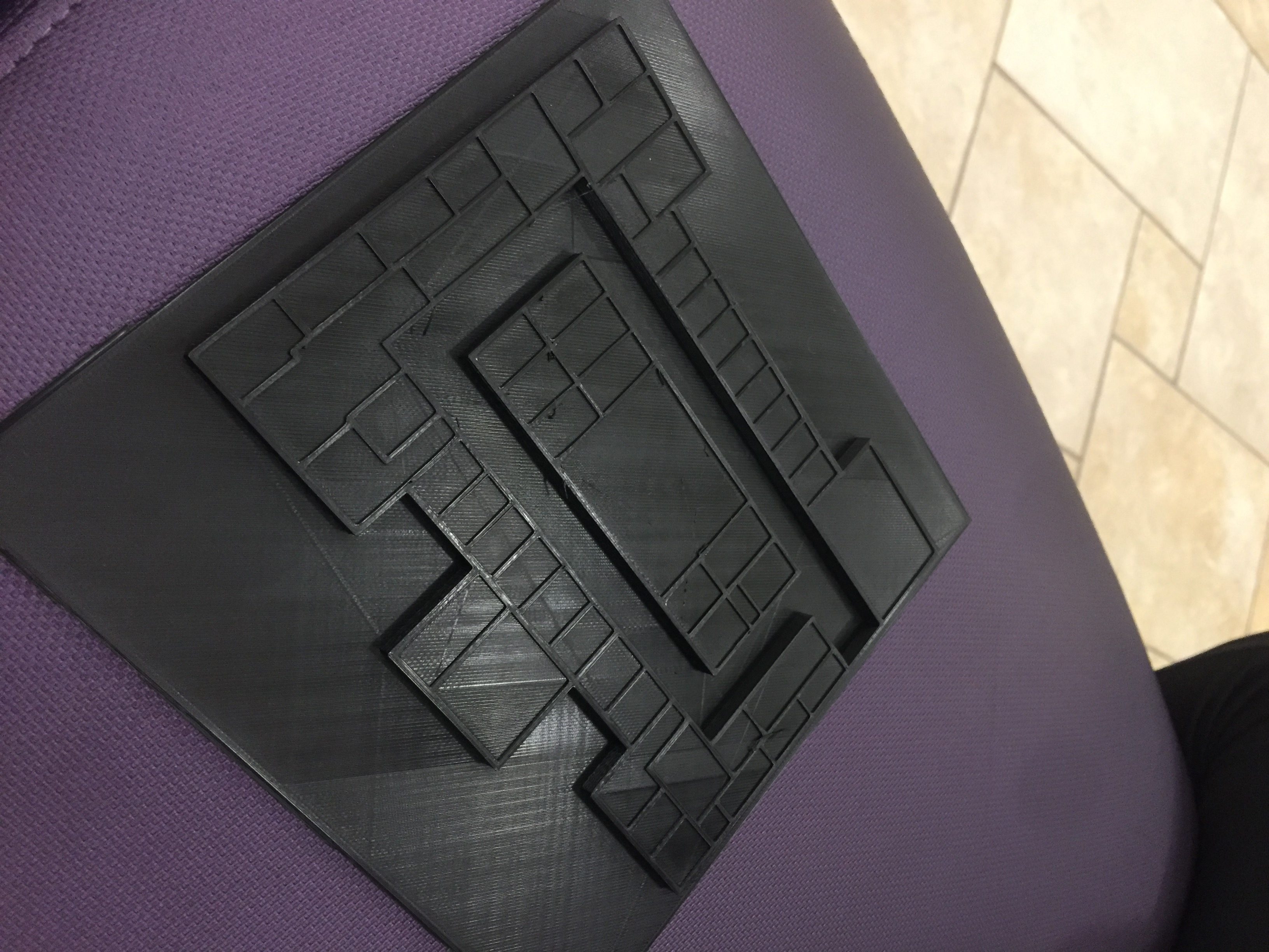
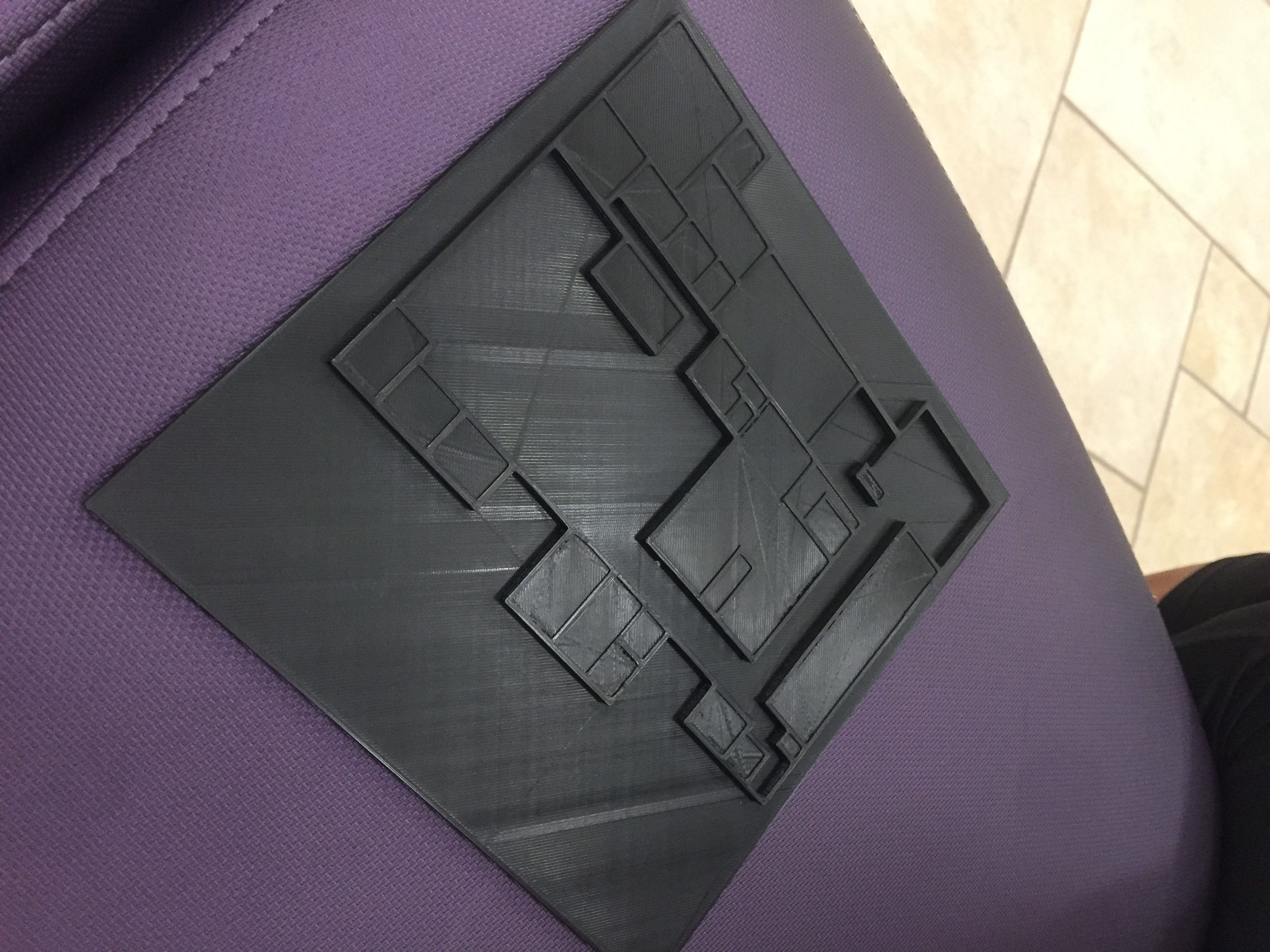
When we met with the office of disability services, we also showed them our progress in the development of our full campus map. They liked the idea a lot and even said that they had a visually impaired student in mind to feel out the map and see if he or she liked it. We experienced a lot of trouble getting the walkways done and this is where we spent most of our time. The process of making the maps consisted of using inkscape to draw black boxes over the buildings in one file for all of the educational buildings, and then for the walkways, we had to trace over the walkways on a separate sheet of paper with sharpie because inkscape didn’t work well for the walkways. Once we were able to sketch that on a separate sheet of paper, we took a picture of it with our phone, then converted the file from a jpeg to a svg so we could import it into tinkercad. We ended up printing the sections of the quad and the skyline buildings, and were almost done with the village section featured below.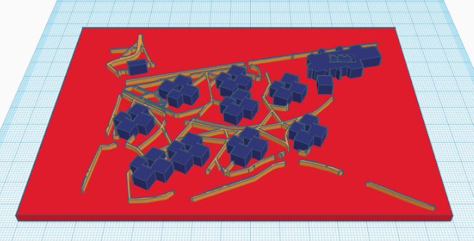
https://www.tinkercad.com/things/dKmv08hWX6z/editv2
https://www.tinkercad.com/things/1PTAeEXSCmB-bluestone/editv2
Here’s the tinkercad file for bluestone, and as you can see, the walkways were a little tricky to incorporate considering there were so many. When we showed this to the disability services office, they were intrigued, but said we would need to inquire further with how and where this could be implemented. Another thing they pointed out was that our prints were relatively small, and for this to have a bigger impact on James Madison University, we would need to have it printed larger. This is where another problem arose; getting the walkways to line up. Because we used the sharpie method, the scaling was sometimes a little off, and we had to deal with the peeling problem with our final prints. Overall, they said that braille probably wasn’t that necessary for this part of the project, but said that if we ever needed help deciding where and what to put, we could bring by what we have and they would take a look. We think this is a good starting point for a project next year if UNST 390 continues, and with the help of some faculty and building administrators, we could potentially have a larger 3d model of the campus that fits together accurately that could be displayed if we find someone nice enough to hear us out and organize where we should put it.